Time 5 am
I woke to a brand new day as I had grown older by a year now. Monday mornings are usually crammed up, bustling traffic, even Mysore is not spared on those frantic Mondays. But, I chose to stay back at home on this special day and plan to visit Himavad Gopalaswamy Betta situated somewhere in bandipur national park.
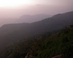
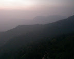
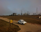
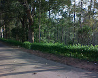
We started around 6am, the sun was steady high and i guessed it would be a very bright sunny day which i thought would take away the essential purpose of visiting the hills. Himavad Gopalaswamy Betta as the name specifies is covered with veiled mist all round the year. That's the specialty of this place. As we slowly started our ascent towards the hills situated at an altitude of 1300m above sea level, the conditions around started changing dramatically. What was supposed to be a bright sunny morning was slowly changing, the clouds were almost covering the peak of the hills almost making it invisible to the bare eyes.
We reached the base of the temple at around 830 and we were almost shivering as the clouds grazing by us gave that punch of coldness.It was as if the clouds were singing in praise of the lord. The sight which behold in front of us was almost like a picture used on my desktop wallpaper.
Nobody was present around the temple. It was just my parents and me and the whole place to ourselves. The temple priest arrives only by around 930 because the only bus to this place arrives by that time. we had the whole one hour to ourselves with nobody disturbing us. And luck what may, soon after walking a few distance away from the temple, we spotted a herd of wild elephants grazing in the plains below:). That was awesome. Watching these beasts in their wild habitat, it was just amazing. The whole place around Gopalaswamy betta is frequented by wild elephants because it falls in the core zone of the Bandipur National Park. We came back to the temple after watching the elephants and the temple priest had arrived by that time. He conducted pooja for us, and explained to us the importance of this place. This temple was built by the erstwhile cholas way back in the 12 century.
Showing posts with label Hills. Show all posts
Thursday, October 30, 2008
Tuesday, August 19, 2008
A ride through Kudremukha Valley
This wasn't in our travel itinerary, we had to visit our ancestral village for a religious function. Our ancestral village is nearby to Manipal and since the road via Shiradi Ghat towards Mangalore, Udupi was being repaired at the time ,we took the road via Kalasa and Kudremukh National Park, so we could visit places like Sringeri and Horanadu. The journey was done during peak summer time and we didn't expect the rain gods to make the weather around us better.
We started off from mysore at 6 in the morning, The drive till Belur cross via Hassan was pretty good, no bad patches but after Belur cross till Mudigere where we take a deviation towards Horanadu was at its worst. potholes every 10 meters greeted us. After Mudigere, The Western Ghats range starts across, We can find vast ranges of Shola grasslands on those hills, ranges of tea and coffee estates which have been cultivated over here since ages.


It was a time of peak summer we travelled towards Kudremukh, and almost the Shola grasslands were dry, since it hadn't been drained by the monsoons. We reached Horanadu via kalasa around noon. Finished our darshan and had our lunch which is served at the temple. Next we drive across to Kudremukh via kalasa, The drive covers most of the area of the the Kudremukh National Park, Once you cross Kalasa you are given a ticket and given atleast 2 hrs to cross the other side of the National Park. Camping is not allowed inside this reserved forest area until and unless you have permission.
Kudremukha National park is one of the most untouched parks devoid of human inhabitation. Majestic shola grasslands cover every inch of the park, even in such peak summer we could feel the breeze coming from the grasslands. I can guarantee this is one of the most scenic drives you will have in your lifetime, 2 hrs through the National Park with no traffic and only birds chirping( Yes!! U need to shut your music system if you are travelling by car), very difficult to sight wildlife but can be excused, because you need to camp over here if you are so interested in Wildlife.
Some of the Scenic pics on the drive through Kudremukh National Park


Fast Facts: Kudremukha
Kuduremukha( ಕುದುರೆಮುಖ in Kannada/Tulu) is a mountain range nestled in Western Ghats at an average height of 1200MSL in Chikmagalur district, in Karnataka. Kudremukha peak is about 1892MSL. It is also the name of a small town situated near the mountain, about 48 kilometers from Karkala and about 20 kilometers from Kalsa. The name Kuduremukha (as it is known by the natives) literally means 'horse-face' (in the local language Kannada) and refers to a particular picturesque view of a side of the mountain that resembles the same. The Kudremukh National Park is the second largest declared Wildlife Protected Area (600.32 km²) of a tropical wet evergreen type of forest in the Western Ghats. Kudremukh National Park is located in Udupi and Chikmagalore districts of Karnataka states. The Western Ghats is one of the thirty four hot spots identified for bio-diversity conservation in the world. Kudremukh National Park comes under the Global Tiger Conservation Priority-I, under the format developed jointly by Wildlife Conservation Society (WCS) and World Wide Fund-USA. Camping is not allowed inside Kudremukha National Park until and unless you have the permission from the Forest Department. You can also check the following link regarding trekking/camping inside the reserved forest
http://www.karnatakawildernesstourism.org/Trekking_opp_in/Kudremukh.htm
Hanumanagundi Falls
On the drive towards sringeri from kalasa, we can reach gangamoola( Birthplace of River Tunga) and the hanumangundi falls. To reach hanumanagundi falls, U need to climb down around 500 steps, but it is worth. This falls will be filled up during monsoon and is a pleasure to watch.


Sringeri:
We had reached Sringeri by around 4pm and we were told the temple opens only at 5, so left with no option but to move around the temple premises, watched lots of Mahseer( katla in kannada) fish on the banks of river tunga, fed them lot of puri's which are available. crossed the tunga river, marvelled the architecture of vidyashankar mandir, and finally, doors were opened into sringeri sharadamba temple. We sat inside the temple for half an hour and then left to our ancestral village.


The route we covered
We started off from mysore at 6 in the morning, The drive till Belur cross via Hassan was pretty good, no bad patches but after Belur cross till Mudigere where we take a deviation towards Horanadu was at its worst. potholes every 10 meters greeted us. After Mudigere, The Western Ghats range starts across, We can find vast ranges of Shola grasslands on those hills, ranges of tea and coffee estates which have been cultivated over here since ages.
It was a time of peak summer we travelled towards Kudremukh, and almost the Shola grasslands were dry, since it hadn't been drained by the monsoons. We reached Horanadu via kalasa around noon. Finished our darshan and had our lunch which is served at the temple. Next we drive across to Kudremukh via kalasa, The drive covers most of the area of the the Kudremukh National Park, Once you cross Kalasa you are given a ticket and given atleast 2 hrs to cross the other side of the National Park. Camping is not allowed inside this reserved forest area until and unless you have permission.
Kudremukha National park is one of the most untouched parks devoid of human inhabitation. Majestic shola grasslands cover every inch of the park, even in such peak summer we could feel the breeze coming from the grasslands. I can guarantee this is one of the most scenic drives you will have in your lifetime, 2 hrs through the National Park with no traffic and only birds chirping( Yes!! U need to shut your music system if you are travelling by car), very difficult to sight wildlife but can be excused, because you need to camp over here if you are so interested in Wildlife.
Some of the Scenic pics on the drive through Kudremukh National Park
Fast Facts: Kudremukha
Kuduremukha( ಕುದುರೆಮುಖ in Kannada/Tulu) is a mountain range nestled in Western Ghats at an average height of 1200MSL in Chikmagalur district, in Karnataka. Kudremukha peak is about 1892MSL. It is also the name of a small town situated near the mountain, about 48 kilometers from Karkala and about 20 kilometers from Kalsa. The name Kuduremukha (as it is known by the natives) literally means 'horse-face' (in the local language Kannada) and refers to a particular picturesque view of a side of the mountain that resembles the same. The Kudremukh National Park is the second largest declared Wildlife Protected Area (600.32 km²) of a tropical wet evergreen type of forest in the Western Ghats. Kudremukh National Park is located in Udupi and Chikmagalore districts of Karnataka states. The Western Ghats is one of the thirty four hot spots identified for bio-diversity conservation in the world. Kudremukh National Park comes under the Global Tiger Conservation Priority-I, under the format developed jointly by Wildlife Conservation Society (WCS) and World Wide Fund-USA. Camping is not allowed inside Kudremukha National Park until and unless you have the permission from the Forest Department. You can also check the following link regarding trekking/camping inside the reserved forest
http://www.karnatakawildernesstourism.org/Trekking_opp_in/Kudremukh.htm
Hanumanagundi Falls
On the drive towards sringeri from kalasa, we can reach gangamoola( Birthplace of River Tunga) and the hanumangundi falls. To reach hanumanagundi falls, U need to climb down around 500 steps, but it is worth. This falls will be filled up during monsoon and is a pleasure to watch.
Sringeri:
We had reached Sringeri by around 4pm and we were told the temple opens only at 5, so left with no option but to move around the temple premises, watched lots of Mahseer( katla in kannada) fish on the banks of river tunga, fed them lot of puri's which are available. crossed the tunga river, marvelled the architecture of vidyashankar mandir, and finally, doors were opened into sringeri sharadamba temple. We sat inside the temple for half an hour and then left to our ancestral village.
The route we covered
"Mysore--> Hassan-->Belur Cross-->Mudigere-->Kalasa-->Horanadu-->Kudremukha-->Sringeri"
Tuesday, June 24, 2008
New Year Getaway: Tamil Nadu Road Trip
Well, It was a time for another New Year and I had to Welcome 2008 in a special way, One thing was it has been one year since I joined the company and the other thing was all my leaves were about to lapse and i needed to use it very badly( Atleast 20 I guess!!). My parents were eagerly looking up to me for this trip.
Soon around, Me and my Dad got around the Drawing Boards chalking out a Plan where would we be spending our New Year and like any other Dad-son Fights we got into an argument. My Dad's plans were to spend the new year on a piligrimage trip and me for a cozy ride to the Hills or Beaches. Later we did reach a compromise, we would be going on a piligrimage trip and also I would be getting my cozy ride to the Hills. Our plans were for 3 days, First day we would be leaving to thiruvannamalai which is the abode of Lord Arunachaleshwara, Next day we would be visiting Brihadeshwara Temple, one of the Great Living Chola Temples in the South and Srirangam. Our Final Day we would be packing off to the Queen of Shevaroy Hills, Yercaud.
We finally packed our bags, I doubly made sure I had everthing with me. My Sony Ericsson K510i, my camera companion. My chargers etc.. We had hired a cab for our entire Journey which would be more than 1000kms.
Day1: Mysore --> Bengaluru --> Hosur --> Krishnagiri --> Uthangarai --> Tiruvannamalai.
The route which would be taking to our destination Thiruvannamalai was Mysore - Bengaluru - Hosur - Krishnagiri - Kathujuganapalli - Uthangarai - Tiruvannamalai. So in order to beat the morning rush in Bengaluru, we had to start of as early as 5 am. We dashed on the Mys-B'luru highway, had a quick breakfast on the way at Kamat Lokaruchi, hit the NICE peripheral Ring Road and we were almost on the Hosur Road by 8 am. Then our ride came to a grinding halt.
Since owning a private cab, we had to pay Road Tax on entering TN and it almost took us one and half hour just to get a ticket for paying the Road Tax.

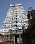
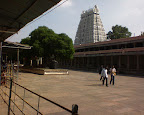
Finally after all the long wait we were on NH7 towards Krishnagiri, Travelling on Hosur- Krishnagiri stretch of NH7 is a driving pleasure. Neatly lined 4-Lane roads almost greets you to drive here. We reached Krishnagiri, took a deviation towards left and one more deviation towards right to Uthangarai. On the stretch, Uthangarai-Tiruvannamalai is the Satanur Dam, which is a perfect picnic spot, but we missed it unable to know which route to be taken. We reached Tiruvannamalai by around 1pm. Tiruvannamalai is situated on the base of Arunachala Hills. The huge and magnificient gopurams are a visual treat to your eyes. There are four gigantic gopurams on each sides of the temple complex.

After finishing our prayers, we started of to the town of Thanjavur at 3 pm ending our journey for the day. On the way we passed by Gingee Fort, fort originally built by the Cholas. We reached Thanjavur at around 1030pm, searched for a decent place to have food. Found a reliable place in Vasanth Bhavan which is a popular Food joint in TN.
Day2: Thanjavur --> Trichy --> Srirangam --> Salem --> Yercaud
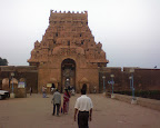
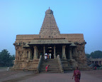
Started of the day by visiting one of the Great Living Chola Temples of Today, Brihadeshwara Temple which is on the UNESCOs World Heritage site List. One round around the site reveals you the work of the artisans and is a brilliant example of the major heights achieved by Cholas in temple architecture. The 'Vimana' or the temple tower is around 216 ft high as written in wikipedia. There is a huge shiva linga inside the sanctum sanctorum. After offering our prayers we started towards Trichy to Srirangam.

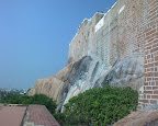
In Trichy, we visited Rock Fort. Interseting fact about rock fort is the rock which dates back 3 billion years, the rock is around 86m high and there is a temple dedicated to Lord Ganesha atop the hill. Had a tough time climbing up the steps, I think the steps were numbering around 600. and even more tough was climbing down after such tough climb up.
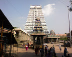
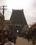
Srirangam is the abode of Sri Ranganathaswamy, a piligrimage center for the vaishnavaites. Most of the people over here are followers of Lord Vishnu. Srirangam is an island on River Cauvery. It is also one of three sacred places on the banks of River Cauvery, one being at Srirangapatna and the other at Shivana samudra. The one thing which catch holds to your eyes is the main Rajagopuram which is about 236 ft in height. Srirangam is believed to be the Largest Functioning Temple complex in the world. Srirangam Temple is inside a series of Rectangular shaped prakaras or elevated enclosures, and each prakaras have a Gopuram, the tallest being on the outermost prakaras.The timings for having a darshan inside the temple premises is only at a particular time, By the time we reached srirangam, it was about 11am and the doors to the main sanctum sanctorum were closed for Darshan and we had to be content by praying to the God from outside.

Later at around 1pm started off towards Yercaud, via Salem Stopping off somewhere near Namakkal for a traditional South Indian Cuisine. The road stretch from Namakkal to Salem is under construction for converting it into a 4-Lane highway from the existing two lane highway. Reached Salem at around 430 pm, the winding ghat stretch was welcoming us like anything, there were atleast 21 hair pin bends we needed to negotiate before reaching yercaud. The climb uphill was thrilling. The cool breeze of the air, The lovely aroma of the trees around, The sound of the breeze hitting the leaves, The small waterfalls pouring down the hills. This would have been a perfect new year getaway for us. My parents had never heard of a place called Yercaud, for them it was only Ooty or Kodai. I had been through a lot of blogs suggesting this place and I wanted my perfect New Year calebrations in style in a hill station. Reached yercaud at around 5 in the evening. Scouted for a pretty little cottages around, booked our rooms. The temperature was cutting down around to 20 degrees, our first visit was to Yercaud Lake. We did Boating over there for half an hour, and then headed towards Lady's Seat. Lady's Seat is a viewpoint where we can have excellent views of Shevaroy Hill rangs and the city of Salem. Light intensity was almost diminishing at around 6pm only!! WOW!! By the time we reached Lady's Seat, It had already been a litttle dark, but the view was stunning! A complete postcard finish for the setting sun!! Took only a few photos, and Yes only a few, coz my good little camera doesn't match the power of modern digital cameras, I dont know what algorithms have been implemented but it fails to take good shots during dusk. Anyways after that we settled for some hot Mirchi bhajjis on the Road side stall. Even my health-conscious dad was having a taste of it. I believe the cold did all the trick :) One good thing about yercaud is it enjoys a pleasant climate all round the year. the temperature was dripping like anything, but it was bearable. Next is to find a good restaurant to have food. And the only thing Yercaud lacks is good restaurants. There is one Hotel shevaroys, which I believe is very good! But we settled for our cottage food, Ordered chapatis, chettinad chicken curry, chicken fried rice, chicken 65 and rice and settled down for our dinner. Veggies would have a tough time over here seraching for food, as most of the food over here is Non-vegetarian! After that we had a long walk in the woods, (in such a cold weather!)

Day 3: Time 6 a.m
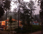
Got up very early,(I had to welcome New Year in a special way, so woke up a bit early. My parents were a lotta surprised seeing me get up so early!) and the view from our cottage was like breath-taking, the morning mist dropping over was forcing me to have a cup of coffee so early in the morning. At around 7 am we started off to the highest point in Yercaud, situated about 5000 ft above sea level. There is a view point over here where you can have a view of the beautiful valley, later we visited the pagoda viewpoint which is at few kms from Yercaud, which also provides excellent view of the valley. At around 10am we started packing our bags to our home!!

Final Journey: Yercaud --> Salem --> Dharmapuri --> Mettur --> M.M.Hills --> Mysore
The last leg of our jouney has no sightseeing places, but we did visit Mettur Dam on the way. Though it is closed for visitors we just had a sneak peek from outside. Passed by M.M.Hills on the way and reached our home at 5pm.
Wow!! What an incredible drive this has been! I never thought I would be enjoying this much on a ride. The trip to
Thanjavur and the architecture over there makes me speechless! you have to be there to experience it. Yercaud is also a good hill station and very dear to your pockets! commercialisation has not ruined this place unlike ooty or Kodaikanal.
Just dreaming that I will be visiting these places sometime sooner. Till then I have to be content looking at the pictures.
The link to my picture album: http://picasaweb.google.com/call2harsh/SouthIndianRoadTripTamilNadu1
Soon around, Me and my Dad got around the Drawing Boards chalking out a Plan where would we be spending our New Year and like any other Dad-son Fights we got into an argument. My Dad's plans were to spend the new year on a piligrimage trip and me for a cozy ride to the Hills or Beaches. Later we did reach a compromise, we would be going on a piligrimage trip and also I would be getting my cozy ride to the Hills. Our plans were for 3 days, First day we would be leaving to thiruvannamalai which is the abode of Lord Arunachaleshwara, Next day we would be visiting Brihadeshwara Temple, one of the Great Living Chola Temples in the South and Srirangam. Our Final Day we would be packing off to the Queen of Shevaroy Hills, Yercaud.
We finally packed our bags, I doubly made sure I had everthing with me. My Sony Ericsson K510i, my camera companion. My chargers etc.. We had hired a cab for our entire Journey which would be more than 1000kms.
Day1: Mysore --> Bengaluru --> Hosur --> Krishnagiri --> Uthangarai --> Tiruvannamalai.
The route which would be taking to our destination Thiruvannamalai was Mysore - Bengaluru - Hosur - Krishnagiri - Kathujuganapalli - Uthangarai - Tiruvannamalai. So in order to beat the morning rush in Bengaluru, we had to start of as early as 5 am. We dashed on the Mys-B'luru highway, had a quick breakfast on the way at Kamat Lokaruchi, hit the NICE peripheral Ring Road and we were almost on the Hosur Road by 8 am. Then our ride came to a grinding halt.
Since owning a private cab, we had to pay Road Tax on entering TN and it almost took us one and half hour just to get a ticket for paying the Road Tax.
Finally after all the long wait we were on NH7 towards Krishnagiri, Travelling on Hosur- Krishnagiri stretch of NH7 is a driving pleasure. Neatly lined 4-Lane roads almost greets you to drive here. We reached Krishnagiri, took a deviation towards left and one more deviation towards right to Uthangarai. On the stretch, Uthangarai-Tiruvannamalai is the Satanur Dam, which is a perfect picnic spot, but we missed it unable to know which route to be taken. We reached Tiruvannamalai by around 1pm. Tiruvannamalai is situated on the base of Arunachala Hills. The huge and magnificient gopurams are a visual treat to your eyes. There are four gigantic gopurams on each sides of the temple complex.
After finishing our prayers, we started of to the town of Thanjavur at 3 pm ending our journey for the day. On the way we passed by Gingee Fort, fort originally built by the Cholas. We reached Thanjavur at around 1030pm, searched for a decent place to have food. Found a reliable place in Vasanth Bhavan which is a popular Food joint in TN.
Day2: Thanjavur --> Trichy --> Srirangam --> Salem --> Yercaud
Started of the day by visiting one of the Great Living Chola Temples of Today, Brihadeshwara Temple which is on the UNESCOs World Heritage site List. One round around the site reveals you the work of the artisans and is a brilliant example of the major heights achieved by Cholas in temple architecture. The 'Vimana' or the temple tower is around 216 ft high as written in wikipedia. There is a huge shiva linga inside the sanctum sanctorum. After offering our prayers we started towards Trichy to Srirangam.
In Trichy, we visited Rock Fort. Interseting fact about rock fort is the rock which dates back 3 billion years, the rock is around 86m high and there is a temple dedicated to Lord Ganesha atop the hill. Had a tough time climbing up the steps, I think the steps were numbering around 600. and even more tough was climbing down after such tough climb up.
Srirangam is the abode of Sri Ranganathaswamy, a piligrimage center for the vaishnavaites. Most of the people over here are followers of Lord Vishnu. Srirangam is an island on River Cauvery. It is also one of three sacred places on the banks of River Cauvery, one being at Srirangapatna and the other at Shivana samudra. The one thing which catch holds to your eyes is the main Rajagopuram which is about 236 ft in height. Srirangam is believed to be the Largest Functioning Temple complex in the world. Srirangam Temple is inside a series of Rectangular shaped prakaras or elevated enclosures, and each prakaras have a Gopuram, the tallest being on the outermost prakaras.The timings for having a darshan inside the temple premises is only at a particular time, By the time we reached srirangam, it was about 11am and the doors to the main sanctum sanctorum were closed for Darshan and we had to be content by praying to the God from outside.
Later at around 1pm started off towards Yercaud, via Salem Stopping off somewhere near Namakkal for a traditional South Indian Cuisine. The road stretch from Namakkal to Salem is under construction for converting it into a 4-Lane highway from the existing two lane highway. Reached Salem at around 430 pm, the winding ghat stretch was welcoming us like anything, there were atleast 21 hair pin bends we needed to negotiate before reaching yercaud. The climb uphill was thrilling. The cool breeze of the air, The lovely aroma of the trees around, The sound of the breeze hitting the leaves, The small waterfalls pouring down the hills. This would have been a perfect new year getaway for us. My parents had never heard of a place called Yercaud, for them it was only Ooty or Kodai. I had been through a lot of blogs suggesting this place and I wanted my perfect New Year calebrations in style in a hill station. Reached yercaud at around 5 in the evening. Scouted for a pretty little cottages around, booked our rooms. The temperature was cutting down around to 20 degrees, our first visit was to Yercaud Lake. We did Boating over there for half an hour, and then headed towards Lady's Seat. Lady's Seat is a viewpoint where we can have excellent views of Shevaroy Hill rangs and the city of Salem. Light intensity was almost diminishing at around 6pm only!! WOW!! By the time we reached Lady's Seat, It had already been a litttle dark, but the view was stunning! A complete postcard finish for the setting sun!! Took only a few photos, and Yes only a few, coz my good little camera doesn't match the power of modern digital cameras, I dont know what algorithms have been implemented but it fails to take good shots during dusk. Anyways after that we settled for some hot Mirchi bhajjis on the Road side stall. Even my health-conscious dad was having a taste of it. I believe the cold did all the trick :) One good thing about yercaud is it enjoys a pleasant climate all round the year. the temperature was dripping like anything, but it was bearable. Next is to find a good restaurant to have food. And the only thing Yercaud lacks is good restaurants. There is one Hotel shevaroys, which I believe is very good! But we settled for our cottage food, Ordered chapatis, chettinad chicken curry, chicken fried rice, chicken 65 and rice and settled down for our dinner. Veggies would have a tough time over here seraching for food, as most of the food over here is Non-vegetarian! After that we had a long walk in the woods, (in such a cold weather!)
Day 3: Time 6 a.m
Got up very early,(I had to welcome New Year in a special way, so woke up a bit early. My parents were a lotta surprised seeing me get up so early!) and the view from our cottage was like breath-taking, the morning mist dropping over was forcing me to have a cup of coffee so early in the morning. At around 7 am we started off to the highest point in Yercaud, situated about 5000 ft above sea level. There is a view point over here where you can have a view of the beautiful valley, later we visited the pagoda viewpoint which is at few kms from Yercaud, which also provides excellent view of the valley. At around 10am we started packing our bags to our home!!
Final Journey: Yercaud --> Salem --> Dharmapuri --> Mettur --> M.M.Hills --> Mysore
The last leg of our jouney has no sightseeing places, but we did visit Mettur Dam on the way. Though it is closed for visitors we just had a sneak peek from outside. Passed by M.M.Hills on the way and reached our home at 5pm.
Wow!! What an incredible drive this has been! I never thought I would be enjoying this much on a ride. The trip to
Thanjavur and the architecture over there makes me speechless! you have to be there to experience it. Yercaud is also a good hill station and very dear to your pockets! commercialisation has not ruined this place unlike ooty or Kodaikanal.
Just dreaming that I will be visiting these places sometime sooner. Till then I have to be content looking at the pictures.
The link to my picture album: http://picasaweb.google.com/call2harsh/SouthIndianRoadTripTamilNadu1
Subscribe to:
Posts (Atom)